Day 1
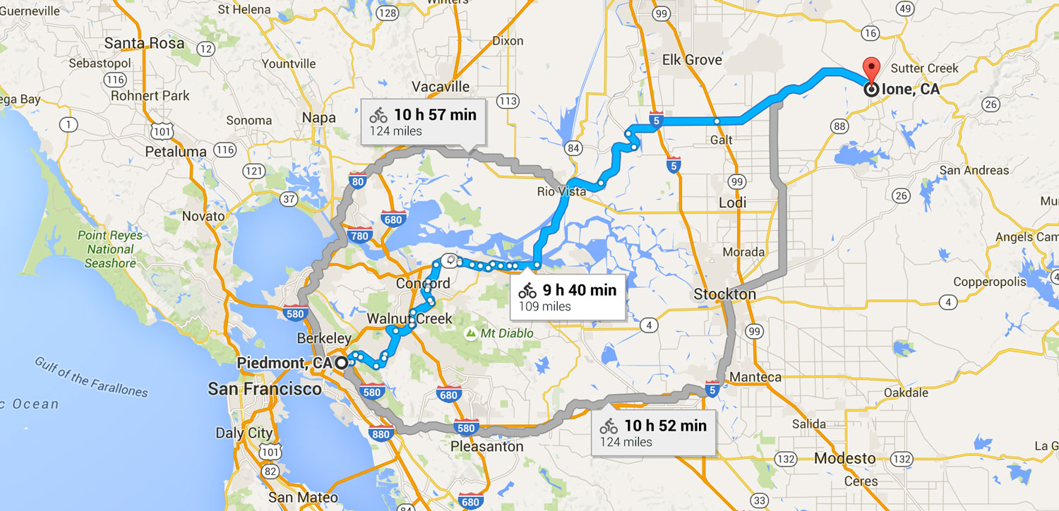
San Fran, CA to Lone, CA
Thursday 1st September 2016
106 miles
Highest elevation – 1,250 ft
Elevation – up : / down :
Day 2
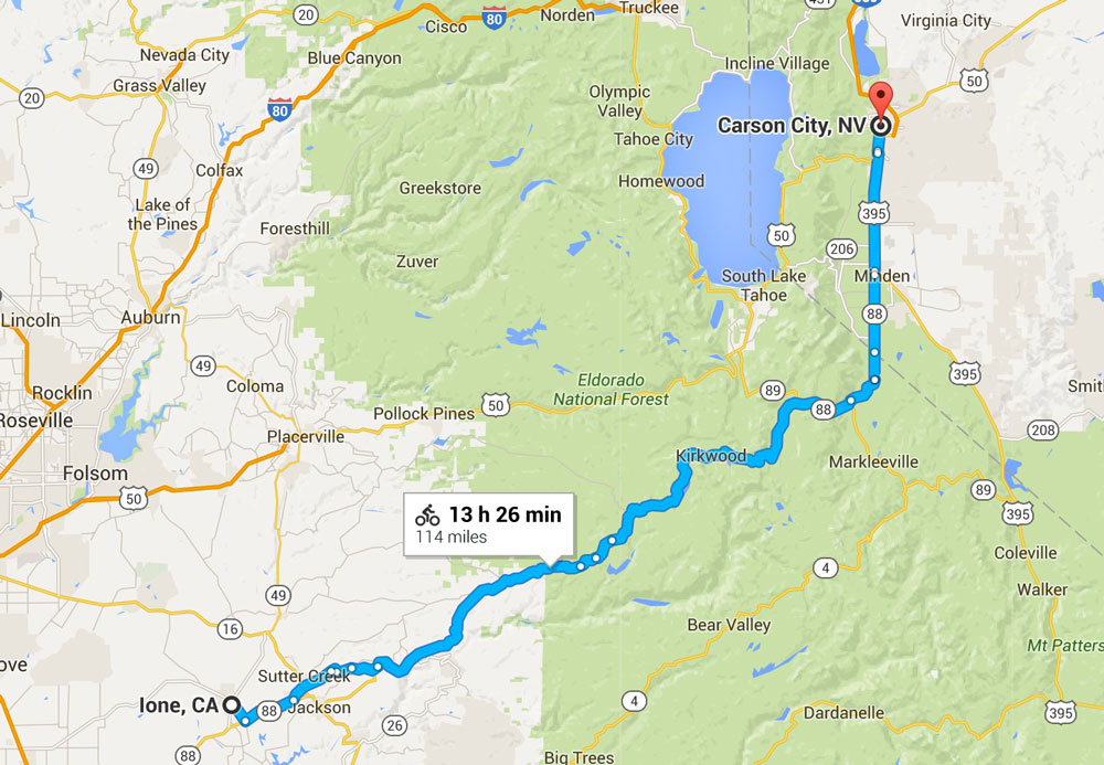
Lone, CA to Carson City, NV
Friday 2nd September 2016
114 miles
Highest elevation – 8,576 ft
Elevation – up : / down :
Day 3
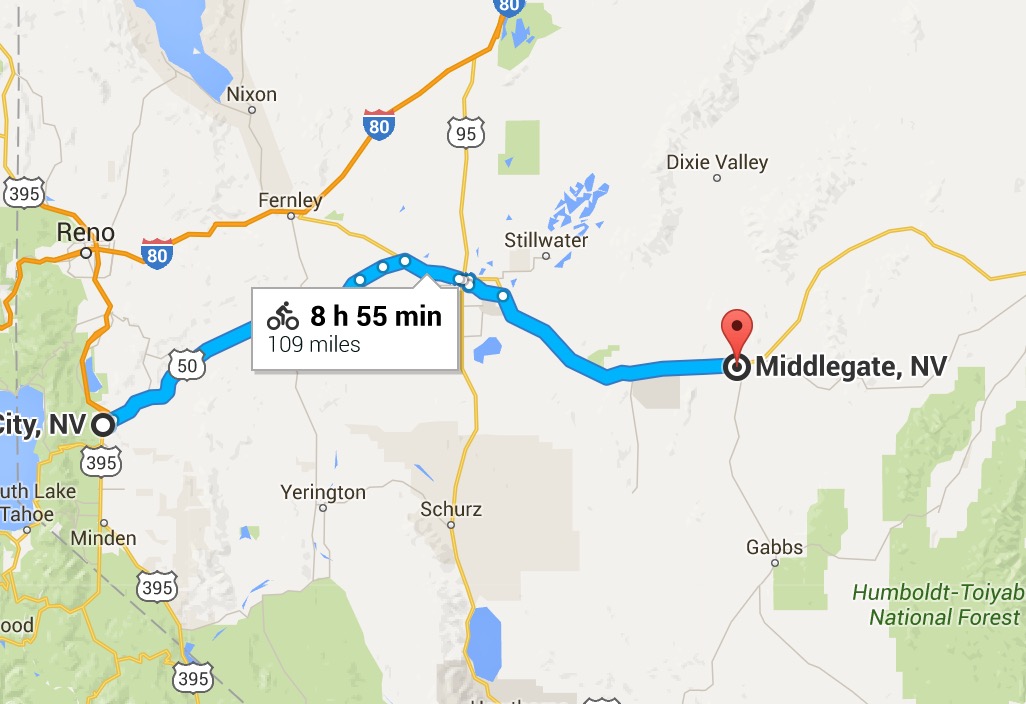
Carson City, NV to Middlegate, NV
Saturday 3rd September 2016
109 miles
Highest elevation – 4,987 ft
Elevation – up : / down : 2,287
Day 4
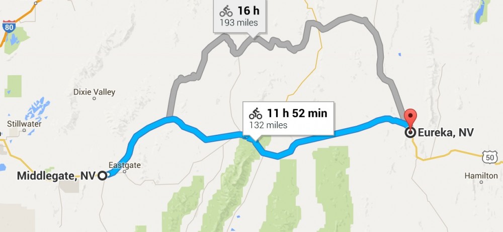
Middlegate, NV to Eureka, NV
Sunday 4th September 2016
132 miles
Highest elevation – 7,470 ft
Elevation – up : / down : 4,183
Day 5
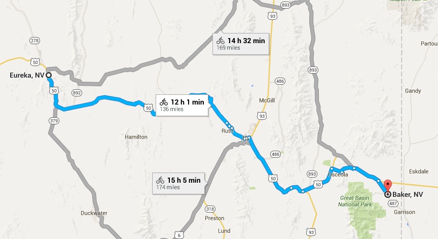
Eureka, NV to Baker, NV
Monday 5th September 2016
139 miles
Highest elevation – 7,700 ft
Elevation – up : / down : 8,304
Day 6
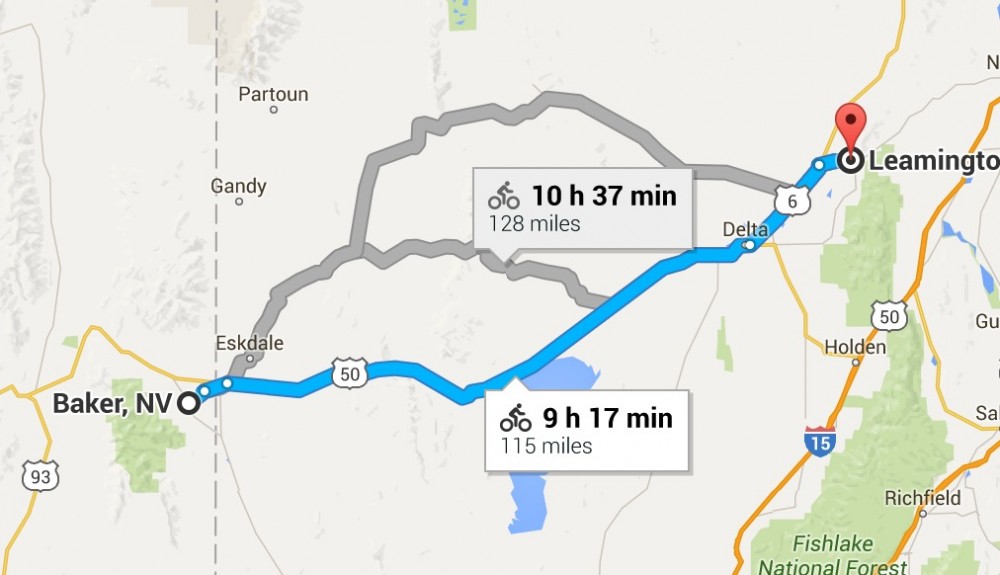
Baker, NV to Leamington, UT
Tuesday 6th September 2016
117 miles
Highest elevation – 6,316 ft
Elevation – up : / down :
Day 7
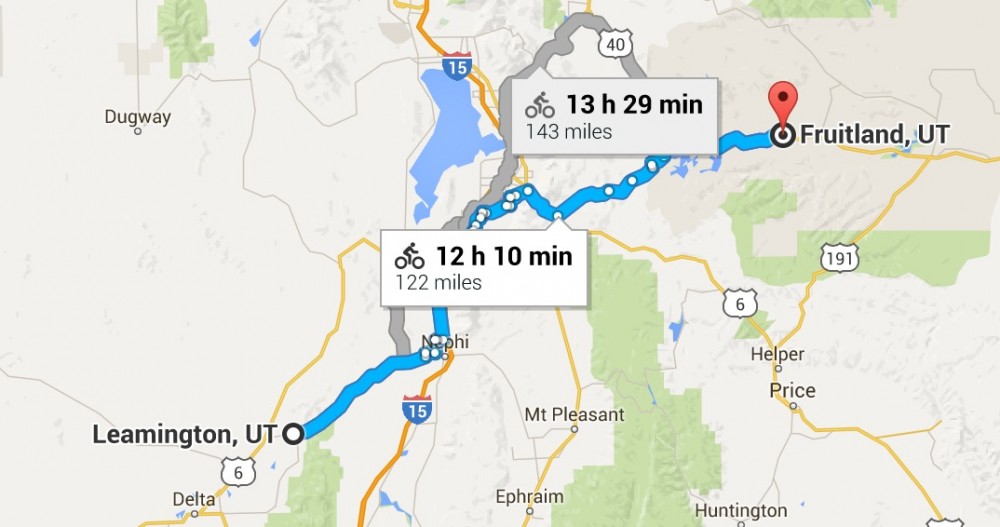
Leamington, UT to Fruitland, UT
Wednesday 7th September 2016
122 miles
Highest elevation – 8,419 ft
Elevation – up : / down :
Day 8
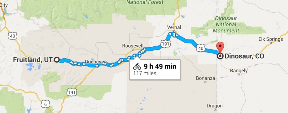
Fruitland, UT to Dinosaur, CO
Thursday 8th September 2016
117 miles
Highest elevation – 6,936 ft
Elevation – up : 3 / down : 4
Day 9
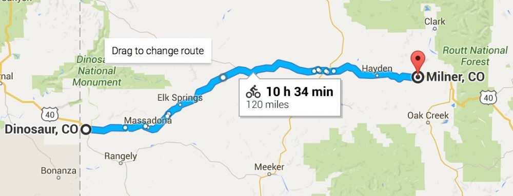
Dinosaur, CO to Milner, CO
Friday 9th September 2016
120 miles
Highest elevation – 6,788 ft
Elevation – up : 4 / down : 3,510
Day 10

Milner, CO to Laporte, CO
Saturday 10th September 2016
144 miles
Highest elevation – 10,400 ft
Elevation – up : / down :
Day 11
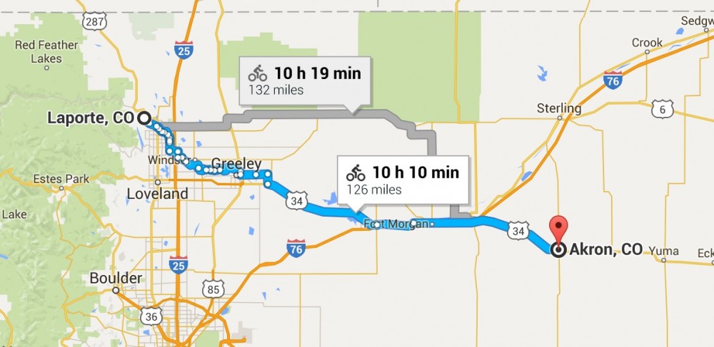
Laporte, CO to Akron, CO
Sunday 11th September 2016
126 miles
Highest elevation – 5,062 ft
Elevation – up : / down :
Day 12
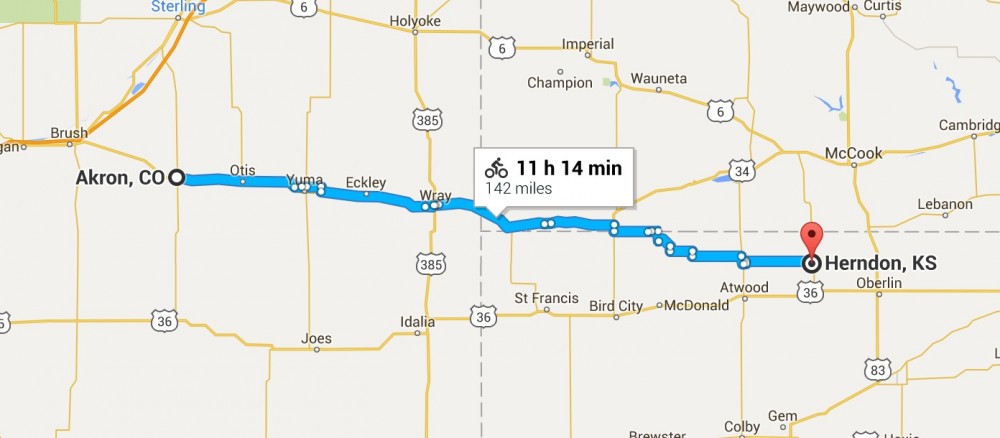
Akron, CO to Herndon, KS
Monday 12th September 2016
142 miles
Highest elevation – 4,659 ft
Elevation – up : 1,893 / down : 3
Day 13
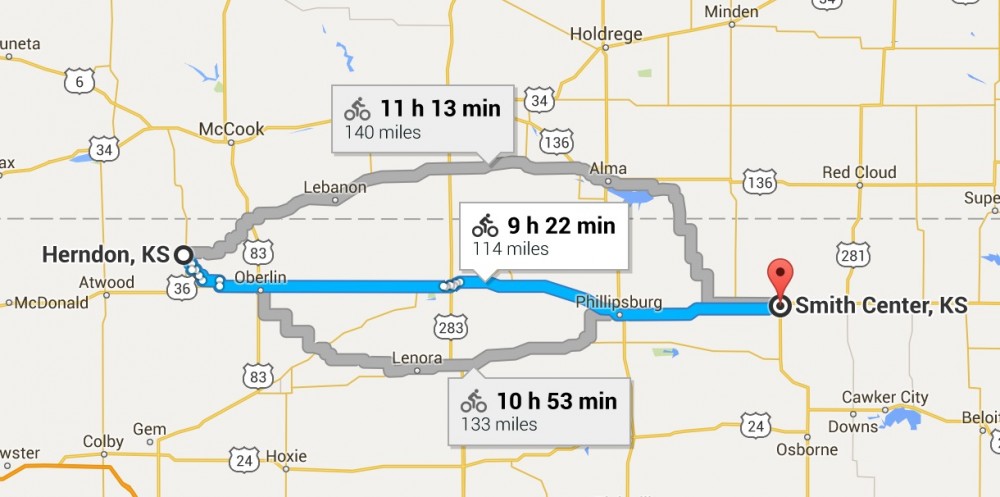
Herndon, KS to Smith Center, KS
Tuesday 13th September 2016
114 miles
Highest elevation – 2,900 ft
Elevation – up : 2,251 / down : 3
Day 14
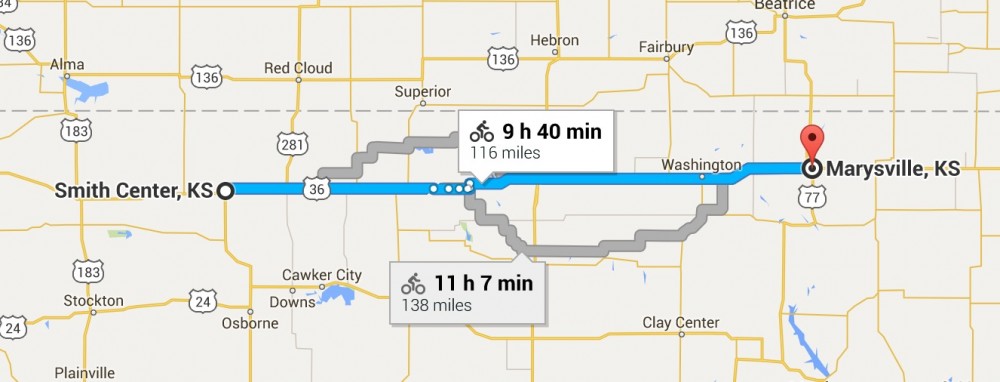
Smith Center, KS to Marysville, KS
Wednesday 14th September 2016
116 miles
Highest elevation – 1,864 ft
Elevation – up : 2,474 / down : 3
Day 15
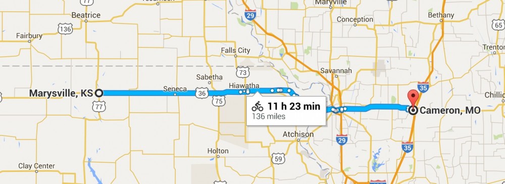
Marysville, KS to Cameron, MO
Thursday 15th September 2016
136 miles
Highest elevation – 1,411 ft
Elevation – up : 3,317 / down : 3
Day 16
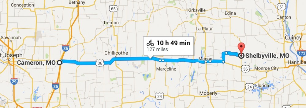
Cameron, MO to Shelbyville, MO
Friday 16th September 2016
127 miles
Highest elevation – 1,030 ft
Elevation – up : 2,927 / down : 3
Day 17
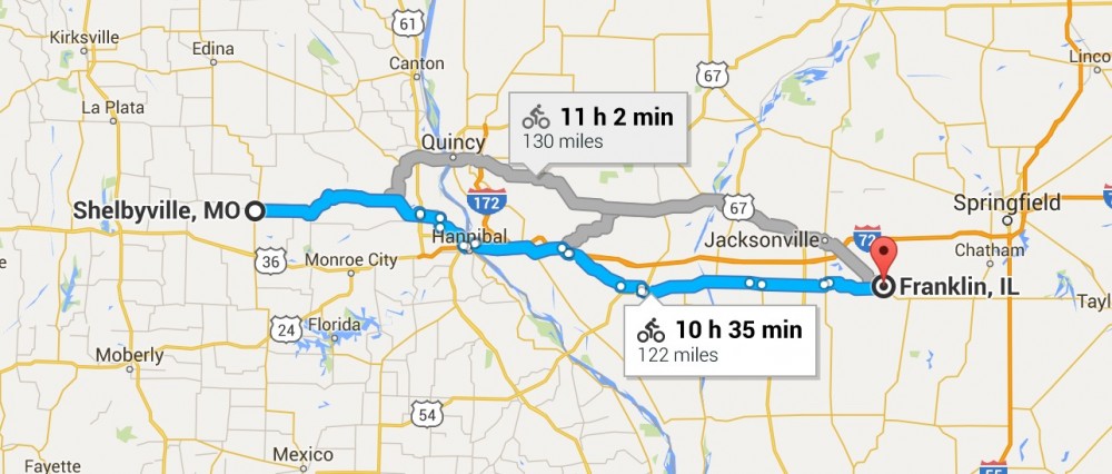
Shelbyville, MO to Franklin, IL
Saturday 17th September 2016
122 miles
Highest elevation – 856 ft
Elevation – up : 2,516 / down : 2
Day 18
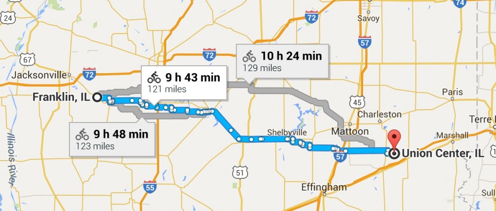
Franklin, IL to Union Center, IL
Sunday 18th September 2016
121 miles
Highest elevation – 689 ft
Elevation – up : 781 / down : 843
Day 19
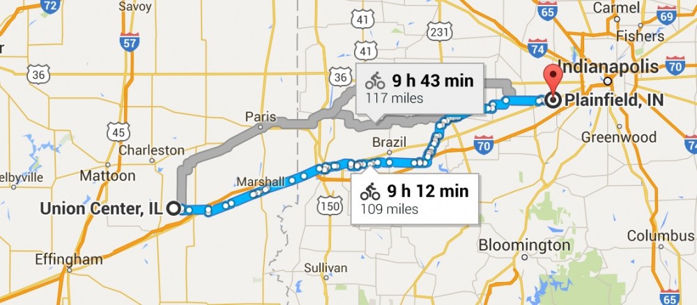
Union Center, IL to Plainfield, IN
Monday 19th September 2016
109 miles
Highest elevation – 922 ft
Elevation – up : 1,706 / down : 1,591
Day 20
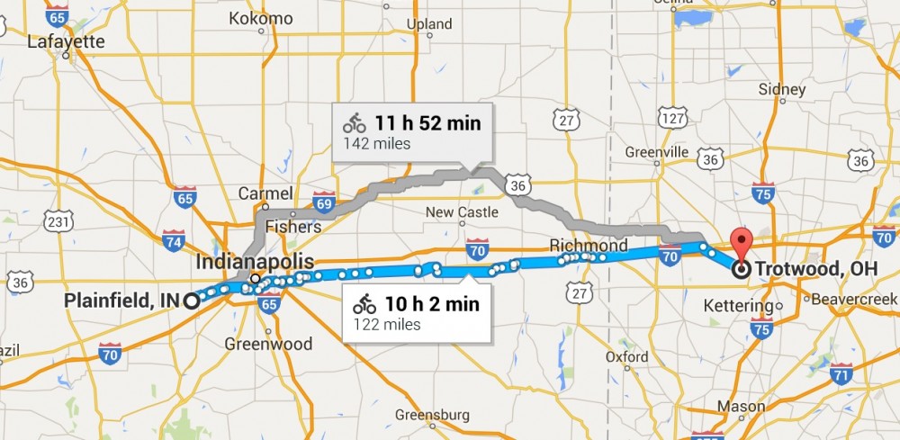
Plainfield, IN to Trotwood, OH
Tuesday 20th September 2016
122 miles
Highest elevation – 1,230 ft
Elevation – up : 1,539 / down : 1,424
Day 21
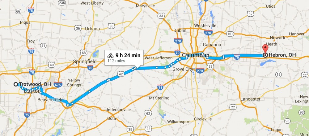
Trotwood, OH to Hebron, OH
Wednesday 21st September 2016
112 miles
Highest elevation – 1,135 ft
Elevation – up : 1,207 / down : 1,152
Day 22
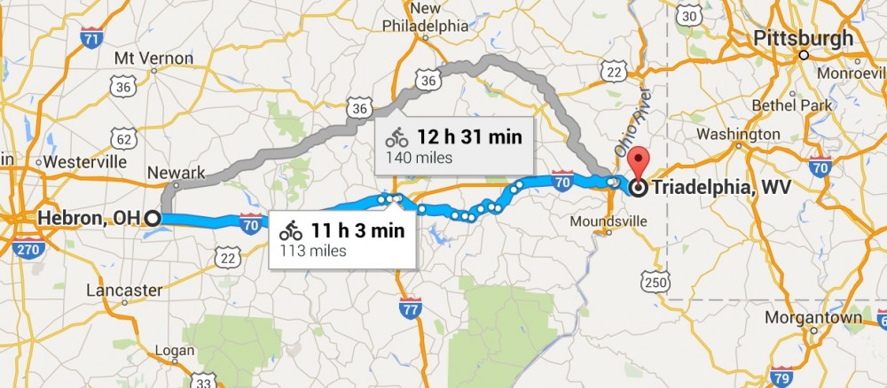
Hebron, OH to Triadelphia, WV
Thursday 22nd September 2016
113 miles
Highest elevation – 1,296 ft
Elevation – up : 4,357 / down : 4,498
Day 23
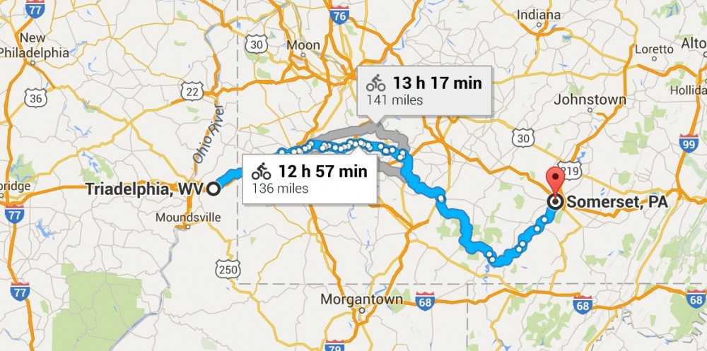
Triadelphia, WV to Somerset, PA
Friday 23rd September 2016
95 miles
Highest elevation – 2,198 ft
Elevation – up : 4,806 / down : 3,360
Day 24
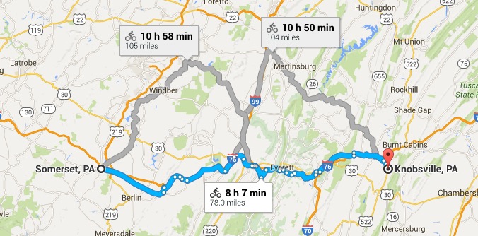
Somerset, PA to Knobsville, PA
Saturday 24th September 2016
78miles
Highest elevation – 2,726 ft
Elevation – up : 4,140 / down : 5,381
Day 25
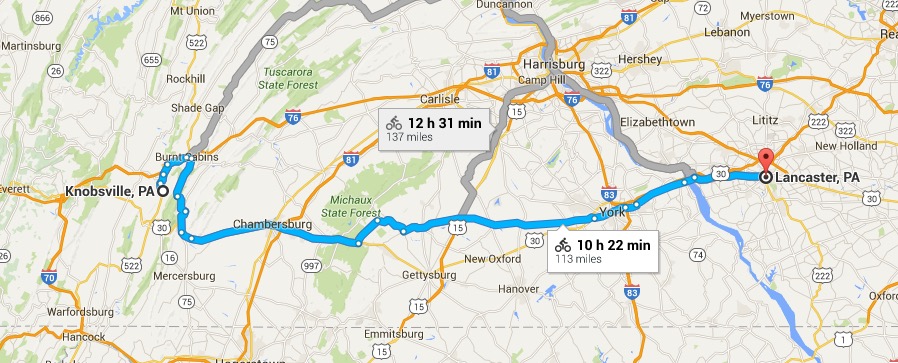
Knobsville, PA to Lancaster, PA
Sunday 25th September 2016
113miles
Highest elevation – 1,368 ft
Elevation – up : 3,665 / down : 4,259
Day 26
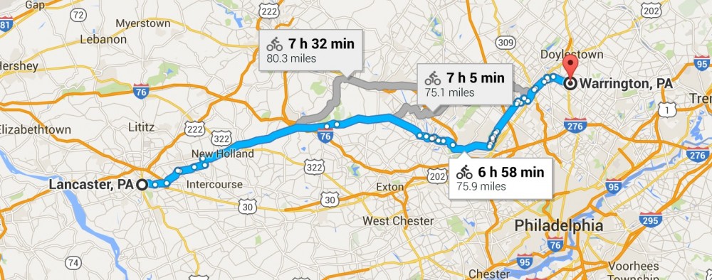
Lancaster, PA to Warrington, PA
Monday 26th September 2016
78miles
Highest elevation – 656 ft
Elevation – up : 2,185 / down : 2,156
Day 27
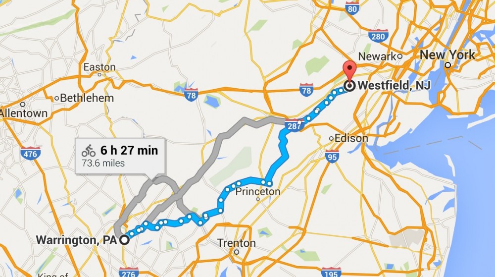
Warrington, PA to Westfield, NJ
Tuesday 27th September 2016
63miles
Highest elevation – 430 ft
Elevation – up : 971 / down : 1,234
Day 28
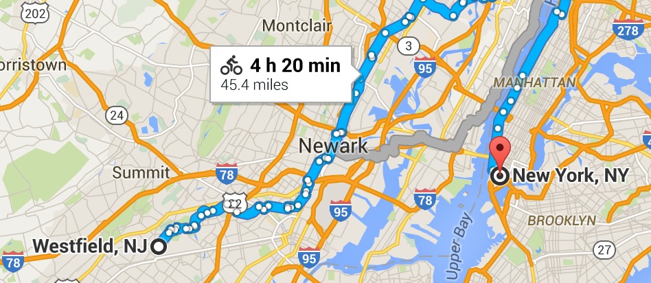
Westfield, NJ to New York, NY
Wednesday 28th September 2016
45.4miles
Highest elevation – 312 ft
Elevation – up : 1,132 / down : 1,227